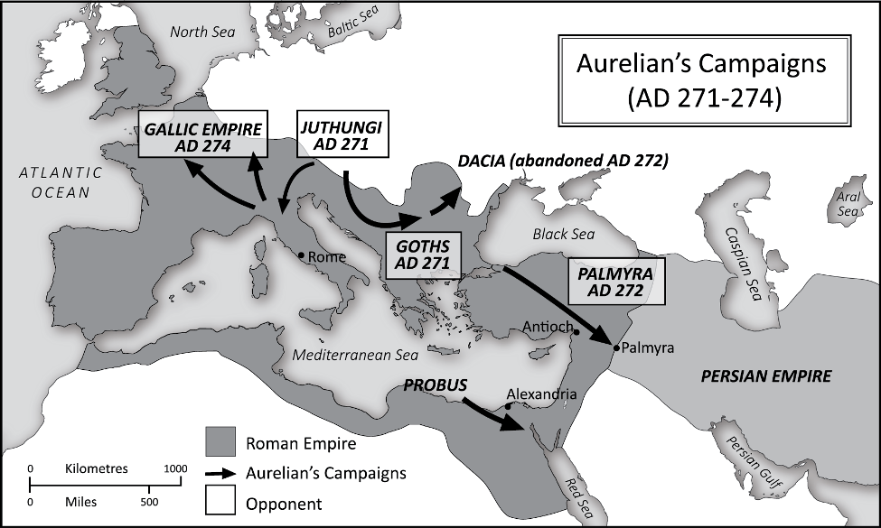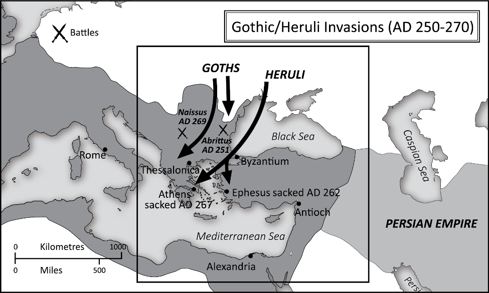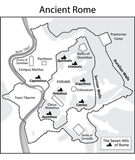
Roman Empire Maps
Client: Nick Holmes (Author)
The author and historian Nick Holmes commissioned me to illustrate a set of 10 greyscale Roman Empire maps.
Eight of the illustrated Roman Empire maps show the expansion of the Roman Empire followed by its gradual break up. The other two maps show the layouts of ancient Rome and Constantinople 330-413 AD.
The maps are used for context in his first book, The Roman Revolution: Crisis and Christianity in Ancient Rome. More information can be found here.
I continue to work with Nick and have designed maps for his other 3 books the details of which can be found here.