Illustrated Maps of France
Client: France Today
France Today commissioned me to design two illustrated maps of France to be used as interactive maps on their website.
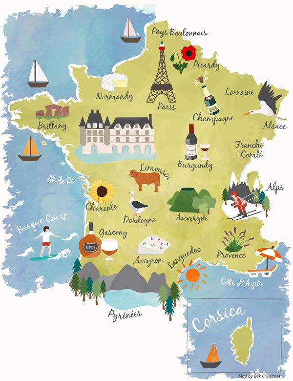
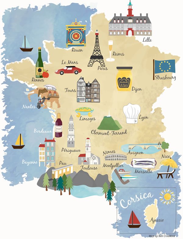
The first map shows the different French regions. It highlights French regional key features such as lavender in Provence and the mountains of the Pyrenees. The second map shows major French cities. Each city is illustrated with a famous feature such as the Eiffel Tower in Paris and the famous mustard of Dijon.
I designed and delivered both maps so they could easily be used as interactive web maps by the France Today in-house developers.
The finished, interactive versions of both maps are live on the France Today website.