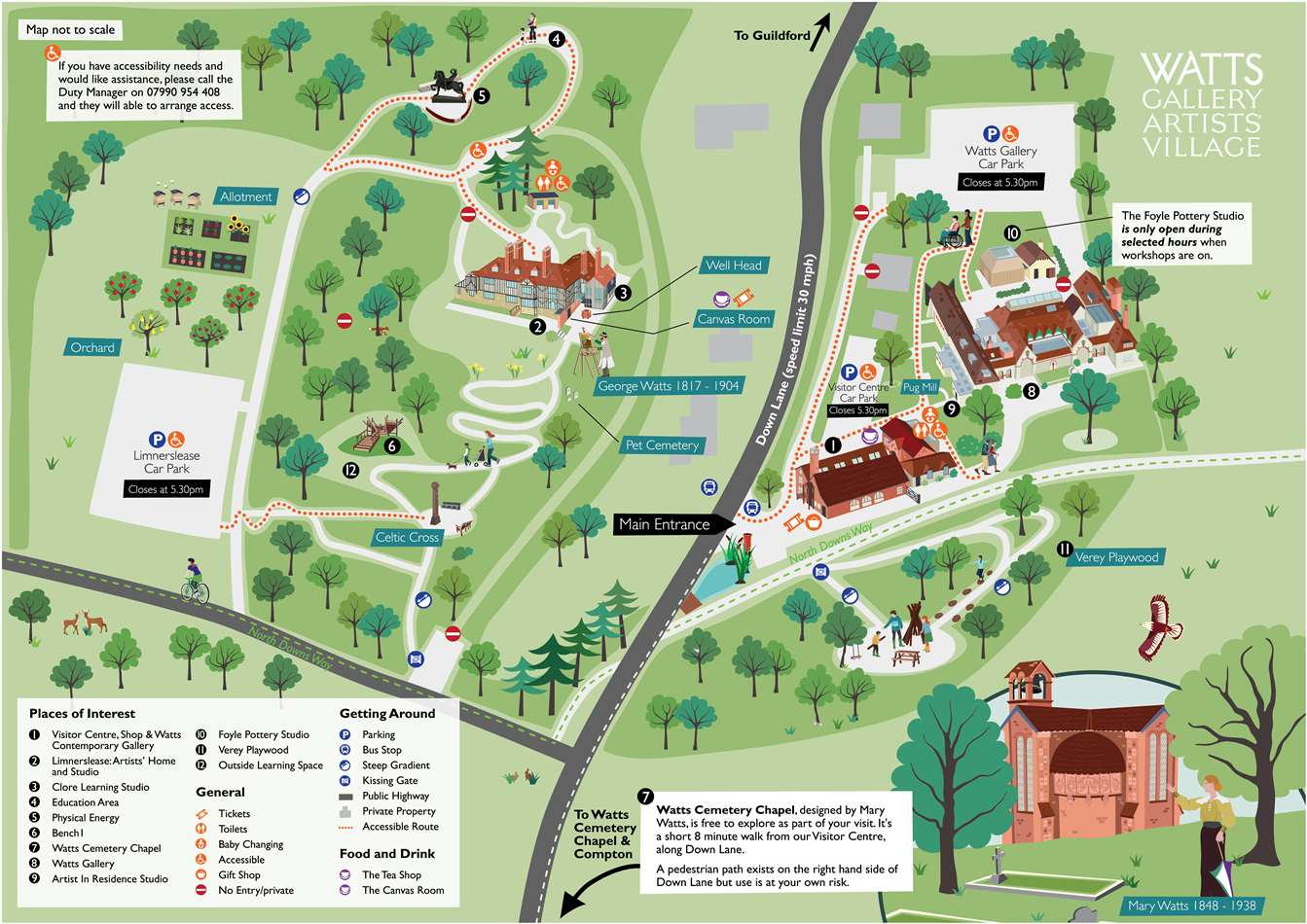
Watts Gallery Visitor Map
Client: Watts Gallery
Watts Gallery commissioned me to design a new visitor map. The design brief was the map should:
- be easy for visitors to use and understand (the site is split over 3 locations)
- it should highlight key assets in an appealing, visual way
- be designed for use as A1 size signage as well as for use as smaller, printed maps and as a downloadable online map
- Be delivered in a flexible format so it could be edited in-house.
- Verey Playwood would be easy to locate
When I designed the Watts Gallery visitor map there were important site-specific features I took into consideration such as:
- road safety – the main sites of the Gallery/parking etc and Limnerslease are divided by a road,
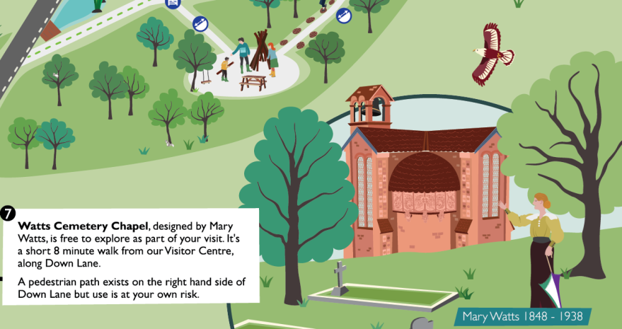
- the inclusion of Watts Cemetery Chapel which is separate from the 2 main sites.
- the changing ground levels and surfaces were also highlighted for visitor access needs.
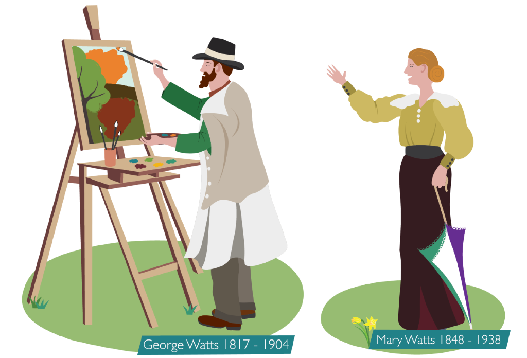
As part of the project, I also illustrated George and Mary Watts so they could be added onto the map and used separately in future marketing.